Land Surveying
Wagga Surveyors and Albury Surveyors
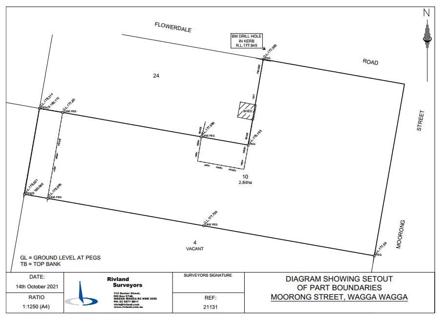
Boundary Redefinition
A Boundary Redefinition Survey precisely and legally defines the boundary of a property. A Redefinition Boundary Survey must be carried out by Registered Land Surveyor, once the Redefinition Survey is complete a Survey Sketch identifying the boundaries is created.
A Boundary Redefinition Surveys assists clearly defines where the boundaries are located and is used for installing improvements such as fences and retaining walls.
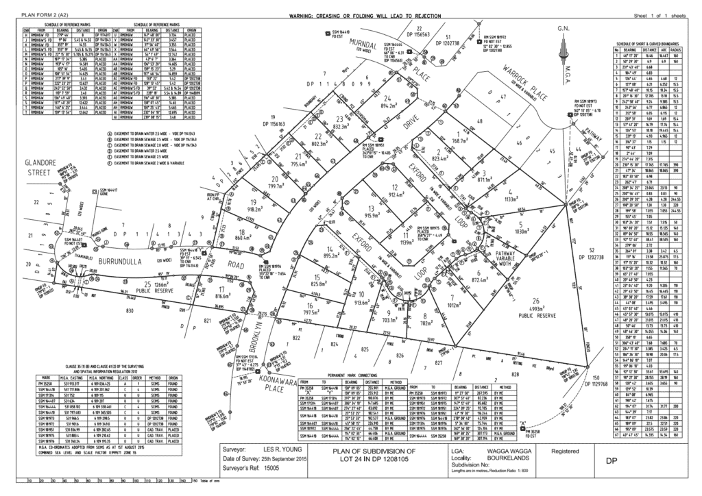
Subdivisions
A Subdivision occurs when a piece of land is divided into smaller parts, it can be a residential block divided in two, a large un-serviced property that has been re-zoned for development or a rural property. There are many reasons why a property might need to be subdivided and it is mandatory for a Registered land surveyor to undertake this process.
It requires a stringent process for approval to create a new Title for each new lot once registered with the NSW Land Registry Services (LRS).
We are able to assist in all aspects of land development including:
- Detail / Contour Survey
- Proposed Subdivision Plan
- Sewer & Stormwater design
- Development Application (DA) preparation (including Statement of Environmental Effects)
- Land and Management Plans
- Flood Plans
- Lodgement of DA with the local Council
- Final Plan of Subdivision (Deposited Plan) preparation
- Creation of Easements and Restrictions (preparation of 88B documents)
Forget dealing with complex government legislation, we can help with specific items as needed or handle it all including electronic lodgement and registration of the Deposited Plan with LRS.
Consolidations
A plan of consolidation is a requirement when two or more lots are being legally combined into one lot under one Certificate of Title. Consolidation plans do not require Council approval however it is often a development consent condition prior to construction commencement.
On some occasions NSW LRS will allow for a Compiled Consolidation (a desktop Plan) however in most instances a full Plan of Consolidation is required. The type of plan required is determined by a Registered Land Surveyor and NSW LRS.
Identification Surveys
Identification Surveys are often required when buying or selling property by both vendors and purchasers or their legal representatives (Solicitors, Lawyers & Conveyancers). It may be required by Council or a Lending Institution as an Identification or Survey Report, as they are sometimes called will clearly indicate the boundary, location of any dwellings as well as any easements or restrictions that may apply to the land.
Easement Plans
An easement is created and registered on a property title to provide a right for someone other than the landowner, to use the land for a specific purpose. An easement can restrict how the owner can use their property and is often a condition of development. Common easements include a shared driveway or pathway and to protect assets such as sewer or water mains.
A Registered Land Surveyor prepares a plan for electronic lodgement via ePlan at the LRS. electronically with the Plan.